Deskripsi
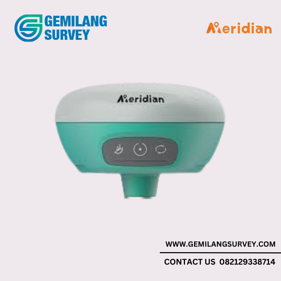
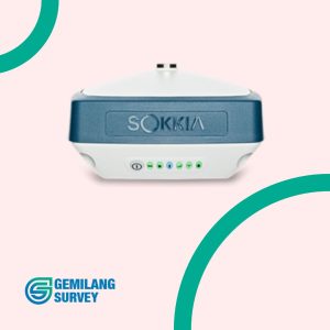
Jika Anda mencari alat survei geodetik yang akurat dan andal, GPS Geodetik Meridian M6 adalah pilihan tepat. Produk unggulan dari Gemilang Survey ini dirancang khusus untuk para profesional di bidang pemetaan, survei tanah, dan konstruksi yang membutuhkan presisi tinggi. Dengan fitur-fitur canggih dan spesifikasi yang mumpuni, Meridian M6 menjadi solusi terpercaya untuk berbagai proyek survei.
Fitur dan Spesifikasi GPS Geodetik Meridian M6
- Akurasi Tinggi dengan Teknologi RTK
Dilengkapi dengan teknologi Real-Time Kinematic (RTK), Meridian M6 mampu memberikan akurasi hingga tingkat sentimeter. Alat ini memastikan hasil survei yang sangat tepat dan minim kesalahan, cocok untuk proyek-proyek kritis. - Baterai Tahan Lama
Meridian M6 dibekali dengan baterai berkapasitas besar, mampu bertahan hingga 12 jam dalam penggunaan normal. Anda tidak perlu khawatir perangkat mati di tengah proyek. - Tahan Cuaca Ekstrem
GPS ini memiliki sertifikasi IP67, yang membuatnya tahan air dan debu, serta dapat digunakan dalam kondisi lingkungan ekstrem, seperti medan berat atau cuaca buruk. - Konektivitas Fleksibel
Meridian M6 dilengkapi dengan konektivitas Bluetooth dan Wi-Fi, memudahkan pengiriman data dan pengelolaan perangkat dari jarak jauh melalui perangkat mobile atau komputer. - Kompatibilitas dengan Berbagai Software Pemetaan
GPS ini mendukung berbagai perangkat lunak pemetaan dan survei yang banyak digunakan di industri, memastikan fleksibilitas dalam integrasi dengan teknologi lain.
| GNSS Signal② | Channels | 1408 |
| GPS | L1C/A,L1C,L2P(Y),L2C,L5 | |
| BDS | L1,L2,L3* | |
| GLONASS | B1I,B2I,B3I,B1C,B2a,B2b* | |
| GALILEO | E1,E5a,E5b,E6* | |
| IRNSS | L1,L2,L5,L6* | |
| QZSS | L1,L2,L5 | |
| SABS | L5 | |
| L-Band | B2b PPP (Only for the Asian-Pacific Region) | |
| Positioning Performance |
High-precision static GNSS Surveying | Horizontal: 2.5mm + 0.1ppm RMS | Vertical: 3.5mm + 0.4ppm RMS |
| Static and Fast Static | Horizontal: 2.5mm + 0.5ppm RMS | Vertical: 5mm + 0.5ppm RMS | |
| Post Processing Kinematic (PPK / Stop & Go) |
Horizontal: 8mm + 1ppm RMS | Vertical: 15mm + 1ppm RMS | |
| Initialization time: Typically 10 min for base and 5 min for rover | ||
| Initialization reliability: Typically>99.9% | ||
| Code Differential GNSS Positioning | Horizontal: ±0.25m+1ppm RMS | |
| Vertical: ±0.5m+1ppm RMS | SBAS: 0.5m (H), 0.85m (V) | ||
| Real Time Kinematic (RTK) | Horizontal: 8mm+1ppm RMS | Vertical: 15mm+1ppm RMS | |
| Initialization time: Typically <10s | Initialization reliability: Typically > 99.9% | ||
| Time to first Fix | Cold start: < 45 s | Hot start: < 30 s | Signal re-acquisition: < 2 s | |
| M-Fix① | Horizontal: RTK+10mm / minute RMS | Vertical: RTK+20mm / minute RMS | |
| Tilt Survey Performance | Additional horizontal pole-tilt uncertainty typically less than 8 mm +0.7 mm / °tilt (2.5cm accuracy in the inclination of 60°) |
|
| Communication | Communication | Bluetooth: 4.2 / 2.1+EDR, 2.4GHz |
| Wi-Fi: frequency 2.4GHz, Supports 802.11 b / g / n | ||
| Internal UHF Radio | Frequency: 410-470MHz | Channel: 116 (16 scalable) | |
| Transmitting power: 0.5W / 1W / 2W adjustable | ||
| Supports multi-communication protocols:TRIMTALK450ST,CHC, HI-TARGET, TRIMMARK III, TRANSEOT, SOUTH 9600, SOUTH 19200 |
||
| Physical | Internal battery | Internal 7.4V / 6800mAh lithium-ion rechargeable battery |
| RTK Rover (Network) for 12 hours | Static: up to 15 hours | ||
| External power | Power consumption: 4.2W | Dimensions (W×H): 132mm×67mm | |
| Charging: using standard smartphone chargers or external power banks | ||
| Weight: ≤0.8kg (includes battery) | Data storage: 8GB ROM internal storage | ||
| Control Panel | LED Lamp | Satellite, Signal, Power |
| Physical button | 1 | |
| Environment | Water / Dustproof | IP68 |
| Shock and vibration | Designed to survive a 2m natural fall onto concrete | |
| Humidity | 100%, condensing | |
| Operation temperature | -30℃~+70℃ | |
| Storage temperature | -40℃~+80℃ | |
| I / O Interface | 1 × USB port, Type C | |
| 1 × SMA antenna connector | ||
| Data Formats | Output rate | 1Hz-20Hz. |
| Static data format | GNS, Rinex | |
| Network model | VRS, FKP, MAC; supports NTRIP protocol | |
| CMR& RTCM | CMR, RTCM 2.x, RTCM 3.0, RTCM 3.2 | |
| Navigation outputs ASCII | NMEA-0183 | |
| 1. *Description and Specifications are subject to change without notice. | ||
| 2. *BDS B2b, GALILEO E6, QZSS L6, IRNSS L5 will be provided through future product upgrade. | ||
Temukan lebih banyak produk survei berkualitas di halaman kategori GPS Geodetik atau kunjungi Gemilang Survey untuk melihat produk lain yang mungkin sesuai dengan kebutuhan Anda.
Untuk informasi lebih lanjut mengenai teknologi survei dan GNSS, Anda dapat mengunjungi situs Meridian M6 , yang menawarkan informasi terkini tentang produk pemetaan dan teknologi geospasial.

Ulasan
Belum ada ulasan.